Information
rich 3d computer modeling of Urban Environments
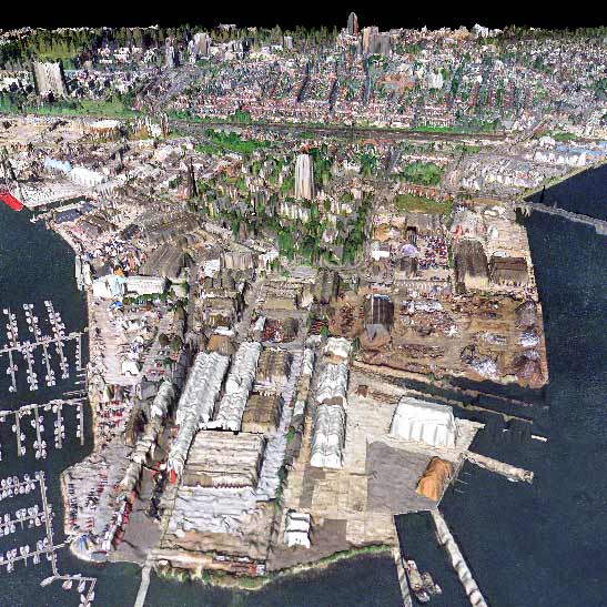
Generating 3d GIS... using LiDAR airborne laser scanners
 |
 |
|
|
Courtesy of Ordnance Survey Crown copyright 2001 |
(LiDAR
= Light Detection and Ranging)
|
|
|
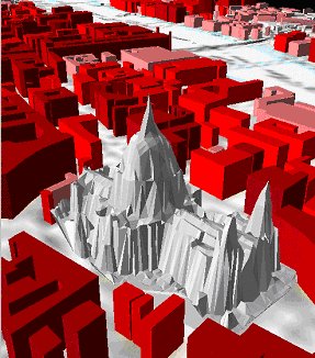
- Can produce 'spiky' gothic look. Lack of truly vertical faces - Requires extensive post-processing to develop an intelligent model |
 |