MODCHEIAS is a raster-based hydrological model, that can overcome particularities of the terrain such as horizontal regions and pit points.
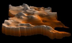
The model uses (simplified) flow dynamics equations, discretizated all over a grid that represents the watershead. This grid is based on the raster digital terrain model (DTM).
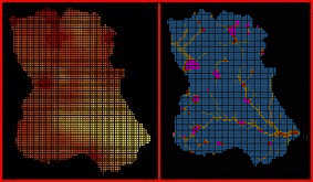
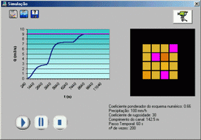
Using the distributed elevation values (without any kind of previous treatment) and the rainfall value (considered as homogenous), distributed water stages are computed, at each time step, and a flood hydrograph is traced in the reference section.
MODCHEIAS was implemented as a stand-alone aplication, fully developed in Visual Basic 6.0, using Map Objects OCX.
Simulations where made, first on test-watersheds to evaluate the influence of the several parameters and test the behaviour of the model, and later on Loures River Watershed, in the N region of Lisbon.
The model proved to be a powerfull tool to evaluate the possibily flooded areas and conjugated with other technologies can provide a strong basis to planning, risk assessment or even flood warning systems.
Joana Simoes: GIS and Programming
Implementing a real-time flood warning system on Trancao river
Grass: Open-source raster GIS