 |
 |
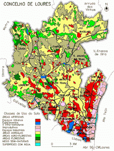
Loures River watershed is situated on the Loures Region, inside Lisbon urban area (AML). It is a sub basin of Trancao River and it represents about 55% of the total area of this basin.
|
|
Besides the fact that the hydrological caracteristics of the watershed can contribute for the existence of flash floods, it is important to remark that Loures River watershed is situated in an area where there is a lot of urban pressure over all kind of soils. It is for these reasons, particullary vulnerable to the flood phenomena.
 |
 |
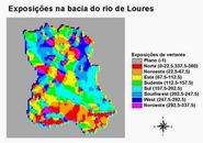
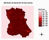
The watershed, is generally very steep and the highest slopes were found on N orientated hills.
 |
 |
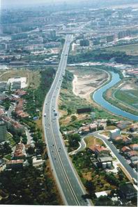
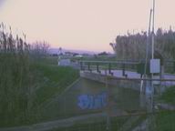
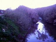
In this study, it was considered the reference section on Ponte de Pinhal (pictures bellow), wich is located at: 38¤N 50N Lat, 9¤ 9W Long and 20 m high.
 |
 |